Attractions
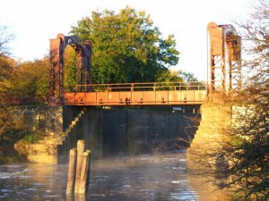
The Hennepin Canal
The Hennepin Canal Parkway State Park is a 104.5 mile linear park spanning five Illinois Counties (Bureau, Henry, Lee, Rock Island, and Whiteside). Construction of the Canal got under way in 1892 and the first boat went through in 1907, reducing the distance from Chicago to Rock Island by 419 miles. The Hennepin was the first American canal built of concrete without stone cut facings. The Hennepin Canal, which at one time was known as the Illinois and Mississippi Canal, was open to boat traffic until 1951. The Hennepin Canal provides a wide variety of recreational activities including fishing, boating, picnicking, canoeing, hiking, horseback riding, bicycling, and snowmobiling.
The Hennepin Canal is also steeped in history and is listed on the National Register of Historic Places. History, Natural Beauty, and Recreation makes the Hennepin Canal Parkway State Park an important resource for all the communities along its banks.
Source: http://www.friends-hennepin-canal.org/what-is-the-hennepin-canal/hennepin-canal-maps
The Rock River
Location: The Rock River begins just to the west of the village of Brandon in Metomen township, Fond du Lac County, Wisconsin and flows southward to the Illinois border ending 325 miles later at the Mississippi River at the Quad Cities in Illinois and Iowa. The river drains 10,280 square miles with about half of this area in Illinois. The Illinois portion of the river has major population centers at Rockford, Dixon, Sterling/Rock Falls, and Rock Island. The remainder of the Illinois portion of the basin is primarily agricultural. The Rock River has low-head dams at Rockton, Rockford, Oregon, Dixon, two at Sterling/Rockfalls, and a split dam at Milan.
The Rock River, which winds 155 miles through northwestern Illinois, is one of the main tributaries to the Mississippi River and provides a diverse fishery. The river provides an aquatic resource of about 12,400 acres as it glides past towns like Rockford, Oregon, Dixon, Sterling and Rock Island before spilling into the Mississippi. Dams at Rock Island, Milan, Sterling, Dixon, Oregon, Rock-ford and Rockton produce fast, turbulent water, and these tailwaters are good spots for walleyes, sauger and white bass.
The river generally averages about 15 feet in depth in the main channel, but between Dixon and Sterling, depths may drop to 50 feet. The bottom is largely bed rock, but there are extensive gravel areas and some places where the bottom is covered with a layer of mud or silt.
From where it departs, Wisconsin to the mouth of the Kishwaukee River, the prime fishing spots are the dams at Rockton and Rockford and the tributary streams, which include the Pecatonica River and Willow Creek. Ramps are located in the Forest Preserve at Rockton, at Harlem Road south of North Park and at Blackhawk Park south of Rockford. There is a small forest preserve just upstream on the south bank of the Kishwaukee.
Pools where the Leaf River enters south of Byron is a good fishing spot as is the water above Oregon and at the dam there. Ramps are located at Byron and Lowden State Park at Oregon where there also is camping with electrical hookups. Ramps are available at Lowell Park on the west bank along Ill. Route 2 north of Dixon, at Page Park in Dixon and Oppold Marina north of Sterling.
Ramps are also located in Sterling, Rock Falls, at a roadside park downstream along Route 2, at Prophetstown State Park where camping and electrical hookups are available, and at the Erie Boat Club.
There are a few access areas south of Erie, and anglers will find many small islands as the stream flows through low farmland. Fishing should pick up where the Green River enters below Green Rock.